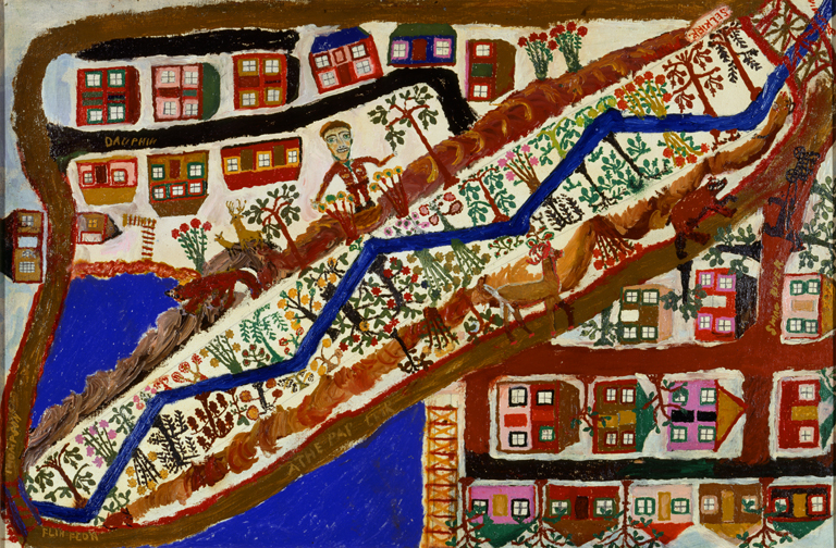
Map of Manitoba, ca. 1980
Oil and pencil on canvas board
24 × 36 in. (60.96 × 91.44 cm)
Gift of Anthony Petullo M2012.164
Photo credit: Efraim Lev-er
Objective: Students will reflect on their own community and environment and create a map of their community.
Look: Show students the painting and explain the backstory behind the painting and the artist. This is a painting done by Jahan Maka, a Lithuanian artist who immigrated to Canada for work. This painting is called Map of Manitoba, which is a province in Canada. Ask students what they notice in the painting. Turn and talk to share.
Wonder: Students will start by reflecting on their own community. Questions to consider:
- Are there any buildings or businesses in your community?
- Are there a lot of houses in your community?
- Are there any bodies of water in your community like lakes, rivers, etc.
- Where do you buy food in your community?
- Where do you like to have fun in your community?
- Wat landscapes do you see in your community? Are there trees? Hills? Buildings?
Share: Students will then be given paper and art supplies to create a map of their own community. Encourage students to use what they brainstormed to add plenty of detail. After everyone is finished, have students do a gallery walk.
Standard: SS.Geog1.a.4-5 Summarize how location (absolute and relative) affects people, places, and environment. Construct maps (paper or digital), charts, and graphs using appropriate elements (i.e., date, orientation, grid, scale, title, author, index, legend, situation).